The photo above is a 3D generated image of Kandale recently scanned by Google Earth.
In 2017, the REVE Kandale Foundation purchased a hand-cranked brickmaking machine in Belgium and had it shipped to Kinshasa, which in turn was transported to Kandale. This was the first step toward making a difference in the community of Kandale.* The vision behind this purchase was that this machine would lay the foundation for a whole host of projects, laid out, yes, one brick at a time…pun intended.
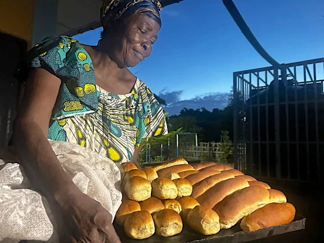
*While the brickmaking machine was the first piece of machinery to arrive in Kandale, Colette has been working in the community and organizing its members since 2010.
This is the view of Kandale in 2017.
This is the view of Kandale in 2019.
In the March 1st, 2020 edition of the Communiqué, https://www.revekandale.org/communique?offset=1605872580943,
(scroll to the bottom),
the many changes to the topography were identified, of which The Multi-Purpose Education Center and the Caritas classrooms are dominant features.

Kandale as of August 1st 2024, courtesy of Google Earth,
https://earth.google.com/web/@-6.04633159,19.34565527,792.54766027a,702.1720014d,35y,0h,0t,0r
The REVE Kandale team has been eagerly awaiting a new scan of the area by Google Earth. It arrived several weeks ago with great enthusiasm. The image of the town is a testament to that progress. The following images present a developing community, that is making a difference in the lives of individuals and families on a day to day business. It is important to understand that this image was scanned during the height of the dry season and many of the features may not be as green as one might expect. One feature of interest is the path, top center in the 3D generated image. It is the arduous path down to the spring. Hopefully by the next scan this path will be mostly grown over.
In the upper right corner of the 2D Kandale photo the two new primary school classrooms can be identified, providing 12 new classrooms to the community.
Just below the classrooms and to the left is the Multi-Purpose Education Center. In the photo on the left side of the building is the new array of ten solar panels and below the panels with the reddish roofs is the water depot with the two water cisterns to its right.
Right below the Water Depot is the rehabilitated garage that houses the two flour grinders. The array of solar panels powering the flour grinders can be seen on the roof. The circular roofs above are the tukuls nestled in the expanding forest.

And tucked down below the classrooms, the Water Depot and the flour grinders are the girls dormitories. They cannot be seen in the photo above, but they are present in the top photo way off to the right.
This final image above is a diagram of where the new classrooms will go. They will be located to the left of the new primary school. Each yellow rectangle represents a block of three classes and with 8 blocks, that's a total of 24 new classes, 12 for Gufwa Gubila high school and 12 for the Lycée. The blue rectangles are for administrative offices, one for each of the high schools. The pink ones are the latrines.
It is highly recommended that you observe these changes on Google Earth, the clarity of the images exceeds what can be presented in this Communiqué. One can even imagine the smaller dots are people queuing for water, accessing the flour grinders, playing cornhole Kandale-style or simply taking the time to share the day, (although they would probably be doing this in the shade). Seven years later the brickmaking machine remains fully operational and will be preparing the next round of bricks that will be used to construct the next series of classrooms. The Communiqué owes a great debt of gratitude to the people on the ground who have been documenting all the changes these past few years. The photos have been remarkable! Thank you!!!